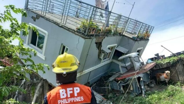
The US Geological Survey reported a 6.0-magnitude earthquake in the southern Philippines on Tuesday, with local authorities warning of aftershocks and potential damage.
The shallow quake struck around 2:00 p.m. (0600 GMT), a few kilometres from Maragusan municipality in Mindanao’s mountainous gold-mining province of Davao de Oro.
Although shallow earthquakes cause more damage than deeper ones, there were no immediate confirmed reports of major damage.
According to an employee at the Maragusan disaster office, authorities are investigating reports of a landslip on a national highway.
“We have not received any reports of other damage or casualties, but we are checking the villages around the town,” he added, declining to give his name.
“Things shook at the office but there was no damage.”
The quake lasted about 30 seconds and was followed by aftershocks, said Corporal Stephanie Clemen, with police in the city of Tagum, about 40 kilometres (25 miles) from Maragusan.
“We immediately went under our desks and when the ground stopped shaking we went straight outside,” Clemen told AFP.
“We are still outside because a moderate aftershock just hit.”
While the quake did not appear to have destroyed anything, Clemen said, it was strong enough to “cause fear”.
Phoebe Alberto and her colleagues at the disaster office in New Bataan municipality, adjacent to Maragusan, fled their building as it shook.
“We are still assessing damage to our building if any. We are here outside now, said Alberto.
In the Philippines, which sits along the Pacific “Ring of Fire,” an arc of strong seismic and volcanic activity that spans from Japan to Southeast Asia and across the Pacific basin, earthquakes occur on a daily basis.
Most are too weak to be sensed by humans, but powerful and destructive ones strike at random, with no technology to forecast when or where they will strike.

