



On September 11, 2009, a rare earthquake measuring 4.8 on the Richter scale struck Abeokuta and several towns across the southwest at approximately 3:10 a.m.
Data from the Centre for Geodesy and Geodynamics, CGG Toro, showed that the tremor, the largest inland quake recorded in Nigeria since digital seismological monitoring began in 2008.
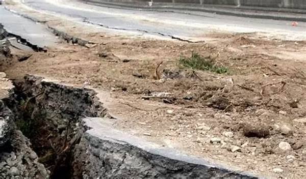

Findings revealed that the tremor was felt in Abeokuta, Ago-Iwoye, Ijebu-Ode, Ilaro, Imeko, Ajegunle and as far as Ibadan and parts of Lagos.
According to eyewitnesses, the earthquake was brief but intense shaking that lasted several seconds.
“I thought it was a heavy truck passing, but the whole house was vibrating. Pictures fell off the wall,” said Mrs. Kehinde Alabi, a resident of Asero.
Scientists say the event challenges the long-held belief that Nigeria is aseismic.
The National Space Research and Development Agency, NARSDA, confirmed it was monitoring the incident.
Speaking during a media briefing, NARSDA researchers noted that the September 11 tremor is evidence that parts of the South West are not entirely free from seismic activity.
“This event serves as a major scientific milestone,” a senior researcher at NARSDA stated. “It proves that southwestern Nigeria, with its underlying fracture zones, cannot be assumed to be completely immune to earthquakes.”
Geologists link the tremor to the reactivation of buried faults in the Precambrian basement, connected to the Romanche and Charcot fracture zones in the Atlantic Ocean. The epicenter was located about 108km west of Lagos at a focal depth of 10km.
Researchers from Obafemi Awolowo University who analyzed the quake said it should prompt a review of building codes, especially with ongoing oil and infrastructure development in the region.
“The peak ground acceleration estimated for the study area ranges up to 0.69g,” noted a 2011 study that used the Abeokuta quake as a case study. “This calls for comprehensive earthquake ground motion modeling in low to moderate seismicity regions like ours.