
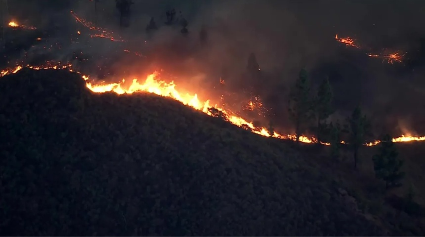
A fast-moving wildfire in the hills above Malibu sent residents scrambling Thursday evening. By late night, the Malibu fire, officially named the Bryson Fire, had burned roughly 200 acres of dry canyon brush north of the coast. It broke out near Encinal Canyon Road and Mulholland Highway at around 5 p.m., and CAL FIRE put it at 200 acres with no containment as of 9:30 p.m. No deaths, injuries or destroyed structures had been reported as of the latest figures available.
How the Malibu fire started and spread
The first reports described a small brush fire. It was first reported at about 2 acres, then reached 35 acres by 5:42 p.m., with firefighters noting active spotting as embers jumped ahead of the main flames. Authorities said it had grown to 80 acres shortly after 6 p.m., and CAL FIRE updated the figure to 101.5 acres about half an hour later.
That is a lot of ground to lose in under two hours. The terrain is part of the reason: steep, rocky canyons filled with dry chaparral, where crews can’t easily drive up and cut a line. Aircraft did much of the early work. Fixed-wing planes flew until nightfall and were able to scoop water from the nearby ocean, and night-flying helitankers kept making drops after dark, according to updates relayed through the Watch Duty app.
The acreage figure has also moved around, which is normal for a fire this young. A later Watch Duty update, citing Incident Command, listed the fire as mapped at 146.2 acres and 5% contained as of 11:33 p.m. Better mapping often revises early estimates in either direction, so expect the number to change again once crews get daylight and aerial imagery.
Evacuation orders and warnings around Malibu
The Malibu fire triggered mandatory evacuations quickly. Orders were issued for zones KAN-U017 and SYC-U016-A, with warnings covering several surrounding communities, including parts of Malibu itself. An evacuation order means leave now. A warning means be ready to go at a moment’s notice.of the fire in Zuma and Trancas Canyons, later extended west of where the fire began, with warnings stretching from the Los Angeles County line toward Point Dume. Areas along Pacific Coast Highway and Point Dume State Beach were under warnings Thursday night.
Institutions in the area moved too. The Los Angeles County Probation Department said it safely evacuated 38 youths from Camp Kilpatrick.
For people who had to leave, an evacuation shelter opened at Agoura High School, 28545 W. Driver Avenue in Agoura Hills, with an animal shelter at the Agoura Animal Care Center on Agoura Boulevard. Officials urged anyone who needs extra time to get out, including people with pets or livestock, to go early rather than wait for an order.
Santa Ana winds, power shutoffs and a red flag warning
The timing could hardly be worse. The fire started under a Red Flag Warning for Malibu and the Santa Monica Mountains, with Santa Ana winds, low humidity and high temperatures expected to last through Saturday evening. The forecast was getting worse, not better. The National Weather Service expected winds to increase significantly overnight, with gusts of 50 to 60 mph possible.
Power was already out in parts of town. Southern California Edison had cut electricity to portions of central and western Malibu under its Public Safety Power Shutoff program. Residents without electricity were told to keep their phones charged, their cars fueled and emergency supplies close, in case more evacuations followed.
Pacific Coast Highway, the lifeline for the whole city, was open in both directions as of 10:34 p.m., while Malibu City Hall announced it would be closed Friday. Road conditions can flip fast during a wildfire, so drivers should check Caltrans and local alerts before heading out.
Governor Gavin Newsom has been briefed, and the California Governor’s Office of Emergency Services said it is coordinating support and resources for local responders. The Los Angeles County Fire Department is the lead agency. The cause is still under investigation.
Why this Malibu fire hits a nerve
Malibu doesn’t need much reminding of what wind-driven fire can do. In December 2024, the Franklin Fire tore through Malibu Canyon and burned 4,037 acres and destroyed 20 structures before reaching full containment. At its peak, about 20,000 people were under evacuation orders or warnings. Older residents also remember the 2018 Woolsey Fire, which swept down to the coast and left a far heavier toll.
Thursday’s blaze is much smaller than either of those, and nothing in the early reports suggests it will match them. The conditions, though, are the ones that make officials nervous: wind, heat and brush that has had all season to dry out.
Containment is the number to watch once the sun comes up. With gusts forecast to stay strong into the weekend, crews are likely to spend Friday protecting homes and holding lines rather than celebrating progress. Evacuation orders can be downgraded within hours if the wind drops, or expanded if it doesn’t. This story is still developing, and the details here reflect reports through late Thursday night Pacific time.